New Zealand Data Zones 2018


Historically in New Zealand, researchers and policy analysts have conveniently used the geographical boundaries constructed for the national census (i.e. meshblocks and Census Area Units) to report small-area or ‘neighbourhood’ statistics. However, there is considerable variation in the population distributions and this can be problematic for small area research. Many meshblocks are too small to publish statistical analyses reliably and CAUs with large populations may skew distributions and/or results.
In response to the need for a standard neighbourhood level geography, a customised geographical base called data zones was developed in 2013 by combining Census meshblocks.
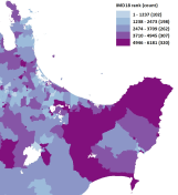
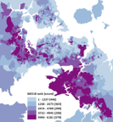
The 2018 version of NZ data zones is comprised of 6,181 data zones that mostly nest within 2013 datazone boundaries. In order to maintain a target population range for 2018 data zones of between 500 and 1200, any 2013 data zones with very low populations were merged with neighbours where possible and those with very high populations were split where possible. Where it was necessary to merge adjacent 2013 data zones because of low populations, the new DZ boundary is comprised of the perimeter of the joined DZs. No meshblocks were split. Combining was not possible for 49 data zones with very low populations (ranging from 399 to 499) due to unsuitable neighbouring data zones, and splitting was not possible for 2 data zones with very high populations (1272 and 1284). 2018 data zones have an average population of 761.
New Zealand Data Zones 2018 cover the entire New Zealand land mass. They exclude oceanic or coastal inlet areas and are comprised of 29,516 SA1 areas (4.78 SA1s per data zone on average) and 52,843 meshblocks (8.55 MBs per data zone on average). Data zones nest within higher geographical units such as General Electoral Districts, Territorial Authorities, District Health Boards (DHB) and Regions.
Data zones were not intended to reflect the true extent of actual communities; rather they are an intermediate geography between meshblock and Census Area Units that facilitates small-area analyses of health and social data at a scale small enough to be statistically robust while also conveying a sense of neighbourhood. In suburban areas they are just a few streets long and a few streets wide.
New Zealand Data Zones 2013
The New Zealand land mass was divided into 5,958 small areas called data zones (DZ). The population of 2013 DZs ranges from 501 to 999 with an average population of 712, with the exception of one DZ representing all of Stewart Island (total population of 384) and 10 large DZs with populations between 1,381 and 1,899 (mostly comprising a single Meshblock).